Skip to outdoor guide
Phoenix neighborhood guides · Sergio Norzagaray · HomeSmart

The neighborhood outdoors

Phoenix hikes, walks & bike rides worth stepping outside for

From the Central Avenue bridle path to mountain views: an outdoor guide for Sunnyslope, North Central Phoenix, Moon Valley and Sheaborhood.

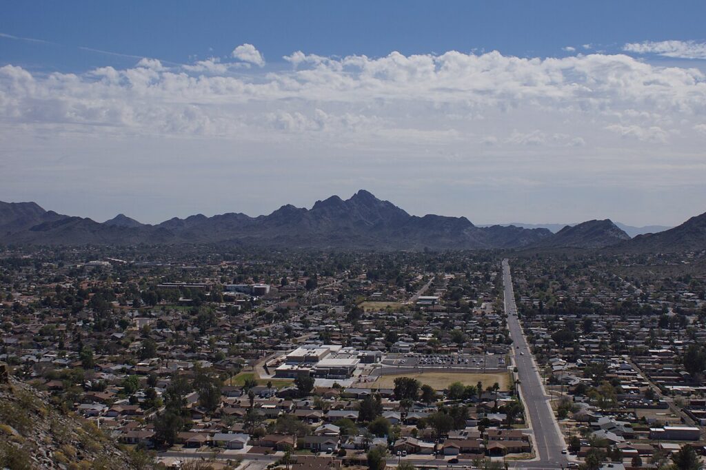
Piestewa Peak and Dreamy Draw seen from Shadow Mountain
Phoenix Mountains, seen from Shadow Mountain in 2014. Chris English / CC BY-SA 3.0. Historical photograph.

Researched October 10, 2026 · Official City of Phoenix and SRP resources linked below.

A morning outside can look different every day

Some days call for a walk beneath the trees on Central. Others call for a pedal along the canal or a climb with the city spread out below you. These four neighborhoods put several kinds of outdoor time on the map. The trick is choosing the right entrance—and a route that fits the day.

Use this guide to pick an outing, then open the official map before you leave. A mountain that looks close from a backyard may have its public entrance on the other side. Nearby does not always mean walkable from every home.

01 / Everyday favorites

Walk, jog or roll at your own pace

North Central Phoenix · Walk / jog

Murphy Bridle Path

Along the east side of Central Avenue, Bethany Home Road to the Arizona Canal

This is the North Central outing to choose when you want trees, a neighborhood streetscape and room for a conversational pace. Walk a short section or make it an out-and-back. The horse-themed gateway at Bethany Home is a recognizable starting landmark.

Unpaved roadside path; watch driveways and use marked street crossings. For a bike outing, choose the canal or Dreamy Draw instead.

Official map & details →

North Central / Sunnyslope corridor · Walk / jog / pedal bike

Arizona Canal

Central Avenue at the Arizona Canal; consult SRP’s map for access and crossings

Pick a turnaround point and make this outing as short or long as you like. The canal gives runners and pedal cyclists an alternative to a mountain climb. Surfaces, shade, lighting and crossings vary by section.

Pedal bicycles are welcome. SRP prohibits motor-powered vehicles on canal trails. Stay clear of the water and maintenance closures.

Official map & details →

Near Sunnyslope, North Central & Sheaborhood · Walk / jog / bike

Dreamy Draw paved bike path

Dreamy Draw Recreation Area, 2421 E. Northern Avenue

Desert scenery without committing to a summit: the preserve’s paved bike path makes a useful option for a ride or an out-and-back walk. Keep the paved path and the rocky hiking trails separate when planning your outing.

Shared path: ride at a considerate speed and give walkers space. Use the official preserve map to plan connections.

Official map & details →

Moon Valley · Casual walk / easy outdoor time

Moon Valley Park

502 W. Coral Gables Drive

For a low-key afternoon, start with the park rather than a mountain. Make a short walk around your visit, then linger at a picnic spot or playground. It is a useful option when the whole outing does not need to revolve around exercise.

Restrooms, drinking fountains and shade structures are listed by the city. Posted park hours: 5:30 a.m.–10 p.m.; check for notices before visiting.

Official map & details →
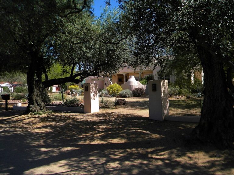
Central Avenue streetscape with the bridle path in the foreground
The Central Avenue streetscape. Jon Roanhaus / CC BY-SA 3.0. File photograph; current conditions may differ.

02 / Desert days

Choose your climb—or skip the summit

There is more to the preserve than the summit photo. A shorter desert walk can be its own destination. Trail runners should choose terrain they can comfortably handle; rocky mountain routes are very different from jogging beside the canal.

Distances below are the city’s listed trail lengths unless marked as loops. They are not all round-trip totals. Include your approach, connections and return when planning.

Sunnyslope / North Mountain edge · Hike

Maxine Lakin Nature Trail

Mountain View II Park, 9901 N. 7th Avenue

A gentler desert option when a summit is more than you want. The city rates this trail Easy and lists 1.2 miles with 190 feet of elevation change.

Natural desert terrain; an Easy rating does not mean paved or shaded.

Official map & details →

Near Sunnyslope · Hike

North Mountain National Trail

Maricopa Trailhead, 10600 N. 7th Street

The mix of asphalt and dirt climbs steeply toward city views. City rating: Moderate/Difficult; listed distance 1.6 miles, elevation change 614 feet.

Check renovation detours before planning this route; the nearby park closure begins December 2026.

Official map & details →

Near Moon Valley & Sunnyslope · Hike / trail run / mountain bike

Trail 100 from the visitor center

North Mountain Visitor Center, 12950 N. 7th Street

Choose a shorter out-and-back along the Charles M. Christiansen Memorial Trail. The city lists the full trail at 10.7 miles, rated Moderate—not the distance every visitor must complete.

Bring the preserve map and choose your turnaround before setting out. Mountain bikes share this trail.

Official map & details →

Near Moon Valley & Sunnyslope · Hike / mountain bike

Shaw Butte

Shaw Butte Trailhead, 12898 N. Central Avenue

A rocky climb with broad Valley views. City rating: Difficult; 4-mile loop. The old Cloud Nine restaurant foundation adds a little local history to the outing.

Steep sections; expect other trail users and keep dogs leashed where permitted.

Official map & details →

Near Moon Valley · Hike

Lookout Mountain

15600 N. 16th Street; park access also at 1898 E. Evans Drive

Choose the 2.6-mile Circumference Trail or the shorter Summit Trail, listed at 0.6 mile with 474 feet of elevation change. Both carry the city’s Moderate/Difficult rating.

A short summit trail still means a climb. Add access distance and the return leg when planning.

Official map & details →

Near Sheaborhood · Hike

Shadow Mountain

Acoma access: 2601 E. Acoma Drive · 28th Street access: 13800 N. 28th Street

A smaller mountain outing with two city-listed loops: Big Loop, 1.6 miles, Moderate/Difficult; Small Loop, 0.8 mile, Moderate.

Neither access point has a designated trailhead parking lot. Respect driveways, posted restrictions and residents.

Official map & details →

Sheaborhood preserve access · Hike

40th Street / L.V. Yates Trail

9200 N. 40th Street, south of Shea Boulevard

A useful east-side entrance to the preserve. L.V. Yates is rated Moderate; the city lists 2.5 miles. Start here when you want a desert hike from the Shea side.

Map your return and any connecting trails. The city lists water, restrooms and a shade ramada at the trailhead.

Official map & details →

Near North Central Phoenix · Strenuous hike

Piestewa Peak Summit

Piestewa Peak Drive; Mesquite access at 2701 E. Piestewa Peak Drive

The big-view workout. The city rates the Summit Trail Extremely Difficult and lists 1,200 feet of elevation change. Rocky steps and a steep climb make it a different outing from a neighborhood jog.

Hiking only: no bikes or dogs on the summit trail. Heat-warning closures apply; check before leaving.

Official map & details →

Want another route near Piestewa? The city also lists the 1.4-mile Piestewa Nature Trail, rated Moderate, and the 3.7-mile Freedom loop, rated Difficult. Check the official trail descriptions before combining routes.

03 / Find your starting point

What is near each neighborhood?

Sunnyslope

Look at North Mountain and Maxine Lakin for desert time; compare the canal and Dreamy Draw for outings with less climbing. Which entrance works best depends on your part of Sunnyslope.

North Central Phoenix

Start with the bridle path and Arizona Canal for an everyday routine. Dreamy Draw and Piestewa Peak add preserve options nearby, with very different levels of effort.

Moon Valley

Pair a casual Moon Valley Park visit with a separate mountain day at Lookout or Shaw Butte. The North Mountain Visitor Center is another useful starting point nearby.

Sheaborhood

The 40th Street trailhead gives the Shea corridor an entrance to the preserve. Shadow Mountain and Dreamy Draw offer other nearby options; compare their actual access points.

These are nearby outing suggestions, not neighborhood boundary definitions or promises of walkable access from every property.

A little planning makes the outing better

Bike routes that fit the bike

Choose the Arizona Canal for a pedal-bike outing, Dreamy Draw’s paved path for a paved preserve ride, or Trail 100 for mountain biking. Piestewa’s summit is closed to bikes. On shared preserve trails, cyclists yield to hikers, and both yield to horses. Follow signs and the city’s trail rules.

Check the day, not just the season

Bring water, sun protection and a route map. During National Weather Service Extreme Heat Warnings, Piestewa’s summit and associated trails close from 8 a.m. to 5 p.m. An open trail does not mean comfortable hiking weather. Check current heat restrictions, closures and the forecast before heading out.

For a picnic, bird watching or a desert photography walk, consider the visitor center or Dreamy Draw rather than making a summit the goal. For ranger-led hikes and nature activities, browse the city’s outdoor programs; dates and registration change.

Questions before you lace up

Where can I walk without a big mountain climb?

Consider the Murphy Bridle Path, Arizona Canal or a casual Moon Valley Park visit. Dreamy Draw has a paved bike path, separate from its rocky hiking routes. Check surfaces and crossings for your needs.

Is “Squaw Peak” the same place as Piestewa Peak?

Yes. Piestewa Peak is the current name of the mountain formerly called Squaw Peak. Use Piestewa Peak when looking up current city maps, parking and trail restrictions.

Can I bring my dog?

Dogs are prohibited year-round on the Piestewa Peak Summit Trail. Where dogs are permitted on other city trails, keep them leashed and follow signs. Phoenix prohibits dogs on city hiking trails at 100°F or warmer. See city heat guidance.

Can I ride an e-bike along the canal?

SRP’s published policy welcomes pedal bicycles and prohibits motor-powered vehicles on canal trails. Check SRP’s current rules and posted signs before bringing an electric bike or scooter.

Is North Mountain closing?

North Mountain Park is scheduled to close December 2026 through early 2028. Other preserve trailheads, including the visitor center, are expected to remain open. Check the city’s project page for changes to individual routes and access.

Are the parking gates open as late as the trails?

Not necessarily. The city lists different entrance and trail hours. Lookout’s north parking entrance also has a sunset-based closing rule. Open the official page for your specific trailhead before planning an evening outing.

Want outdoor time to be part of your next neighborhood?

Talk with Sergio Norzagaray at HomeSmart about homes in Sunnyslope, North Central Phoenix, Moon Valley or Sheaborhood. Compare the actual routes from a home to the public entrances you would use.

Let’s talk about your next move

Maps & local resources

This guide draws on official resources, checked October 10, 2026. Recheck access, hours, construction and heat restrictions before each outing.

Find neighborhood events · Buying a Phoenix home